Hamburg: River City and Major Port
![]()
The River Elbe, one of the great rivers of Europe, begins as snow melt in the high mountains of the Czech Republic. From there it flows westward more than 1000 kilometers through Germany, past Dresden and Magdeburg, on past Hamburg and into the North Sea.
Hamburg sits at the confluence of the Alster with the Elbe at a point where there is high ground on the Elbe's north bank. The meandering river has formed many inselen (islands) here, providing safe harbors for ships.
The Free and Hanseatic City of Hamburg, one of the 16 states of the German federation, is the second largest city in Germany, after Berlin, with 1.9 million inhabitants. It is truly a River City. Without the Elbe River, Hamburg wouldn't be the economic power it is today!
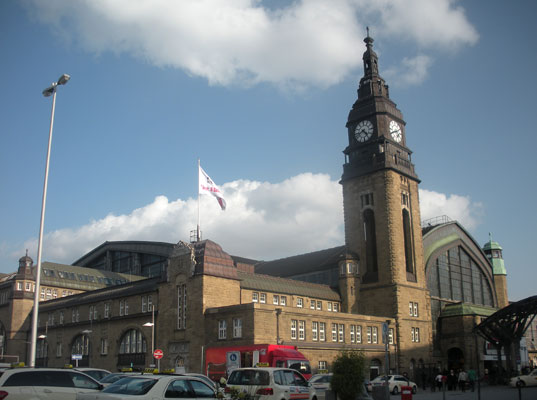
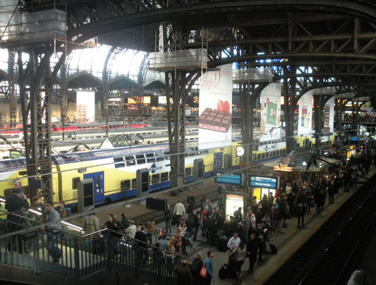
Arriving by train from Erfurt in Thuringia, we were immediately immersed in the chaotic activity of a major German Hauptbahnhof (Main Train Station).
We proceeded to our new home, a spacious apartment in Neustadt, one of the city's oldest neighborhoods, and a short walk from the Elbe.
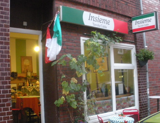
As we explored our new neighborhood, we discovered several friendly cafes, three food stores, and three transit stops to enable city-wide exploration. This small Italian place with great food and nice owners was perhaps our favorite.

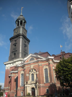
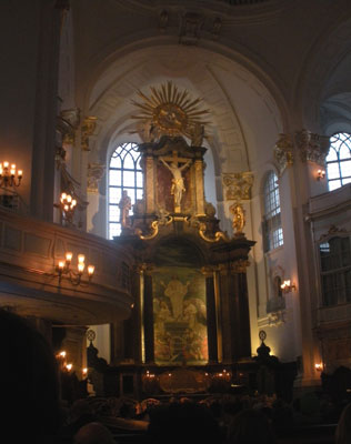
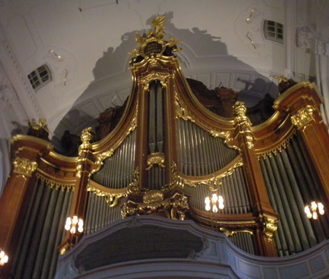
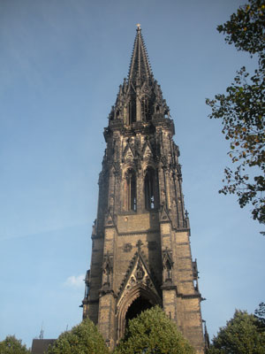
Our great landmark was the towering, dark spire of the St. Michaeliskirche just a few blocks away. The kirche, one of the five great churches of Hamburg, is a major visitor attraction so we had to dodge tour buses and crowds as we walked past, a minor challenge.
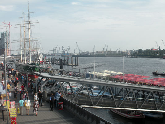
Soon after moving in, we headed to the river front at Landungsbrucken, a series of quays and landings at the ufer (edge) of the river. The day was warm and locals and visitors alike had flocked here for boat rides, ferry trips, or just to sit and relax with a cold beer.
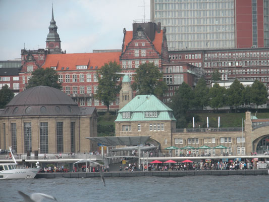
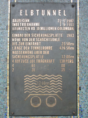
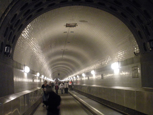
Adjacent to the Landungsbrucken was the ElbeTunnel, built in 1907-11 to provide an alternative means for residents to cross the river on days when ferries couldn't operate.
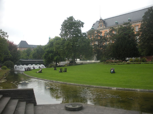
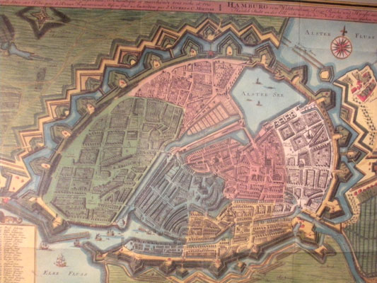
For walks we had the nearby Grosse Wallanlagen, now a great greenway where the great walls that protected Hamburg once stood. As shown on this historic map, these walls formed a ring around what is now the Altstadt and the Neustadt, which together formed the historic city center. St. Michaeliskirche is in small square at the bottom of the green area on the left.
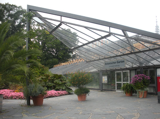
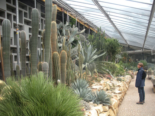
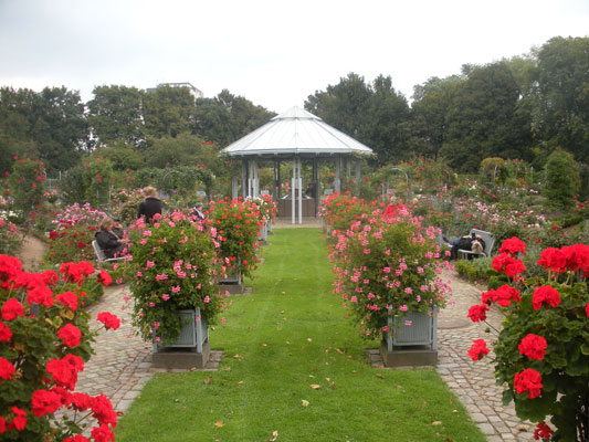
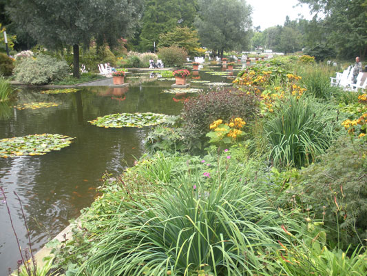
Strolling the Grosse Wallanlagen, we soon reached the Botanical Garden.
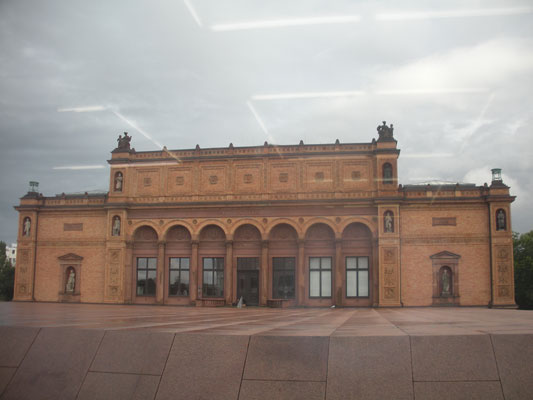
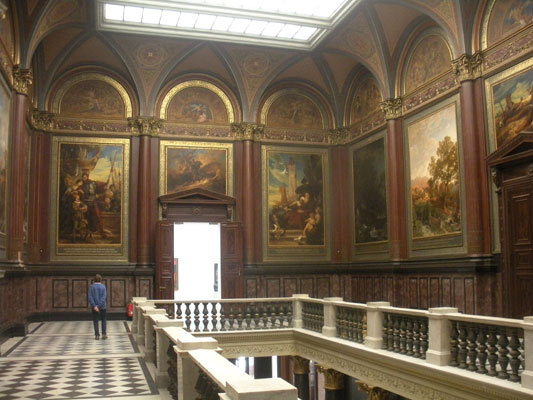
On another day, we visited their wonderful Kunsthalle Art Museum.


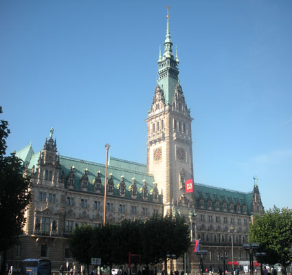
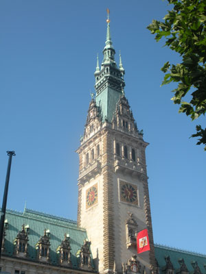
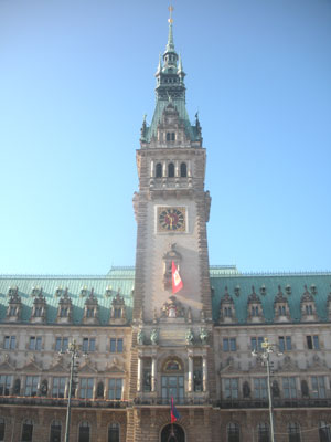
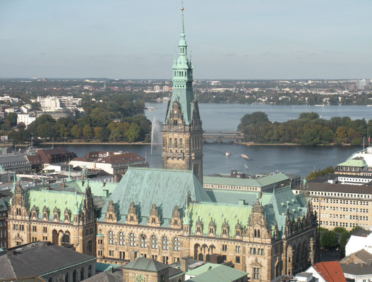
Today, the Rathaus (City Hall) stands grandly at the center of Hamburg's extensive pedestrian shopping and business district.
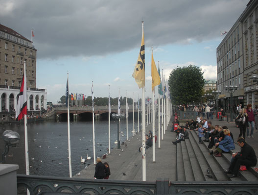
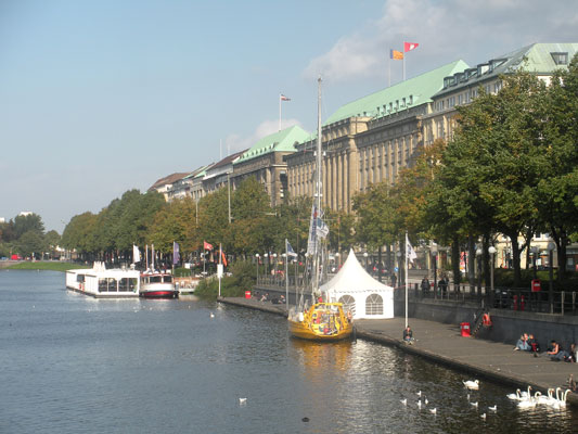
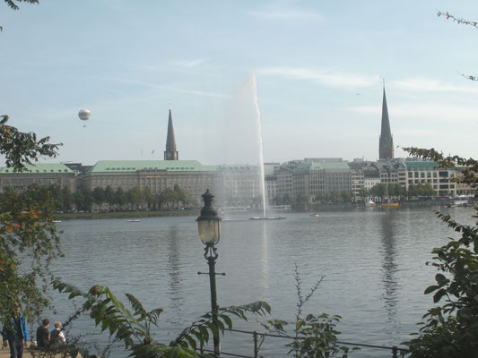
The Alster river that once flowed through the Altstadt was constrained long ago to provide power for mills. Today, only 150 meters from the Rathaus, the resulting Alster lakes still provide a pleasant waterfront with cafes, boat cruises, walking and biking paths along the edge and desirable locations for the grand homes of wealthy merchants.
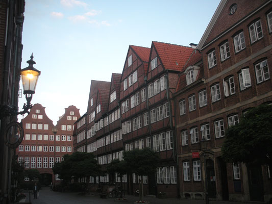
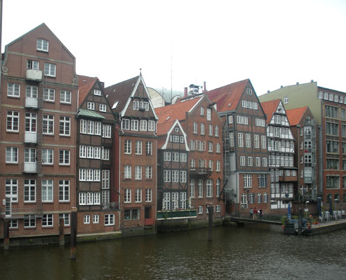
Also within the old walls but closer to the river were narrow streets lined with the stately red brick buildings so characteristic of Hanseatic Cities ....
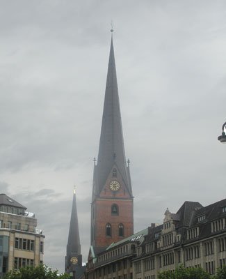
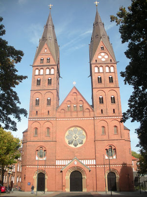
... as well as the five hauptkirchen, St. Petri, St. Katharinen, St. Nicolai (not rebuilt and now a memorial), and St. Jacobi (not shown), in addition to Michaeliskirche.
Hamburg's Port
A visit to the Hamburg Historical Museum provided us with a clear perspective about the essential importance of the Elbe and the Port to the City of Hamburg.
The Port of Hamburg was officially opened on 7th May 1189, when Emperor Frederick Barbarossa guaranteed Hamburg privileges such as customs-free travel along the lower Elbe to the North Sea and the right to hold markets in an imperial charter.
In 1241, Hamburg along with Lubeck, an important German port on the Baltic Sea, founded the Hanseatic League and over time, many European, Scandinavian and English ports became Hanseatic Cities. Under these special privileges and agreements, Hamburg grew and prospered.
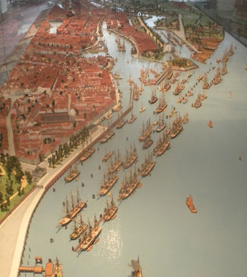
During the 1800s, harbor basins:(hafens) including Sandtorhafen,:Grasbrookhafen, Magdeburger Hafen, Brooktorhafen and Baakenhafen were constructed to respond to the demands of steamships for deeper and wider berths. To protect the port facilities from flooding, the previously low-lying marshland was progressively raised to four to five meters above sea level.
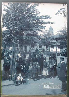
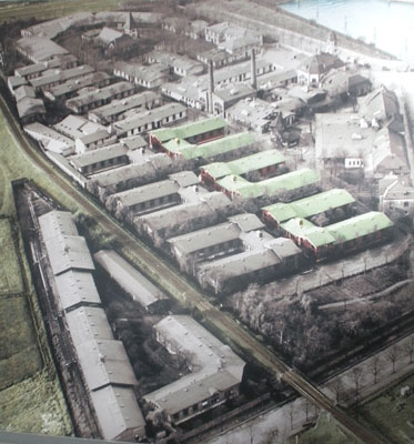
At the same time, due to economic depression and political unrest, millions of people from all over Europe left for the US and Canada from the Ballinstadt facility across the harbor. In the few buildings still left a multi-media museum enables visitors to learn the stories of why people left and their experiences on the voyage.
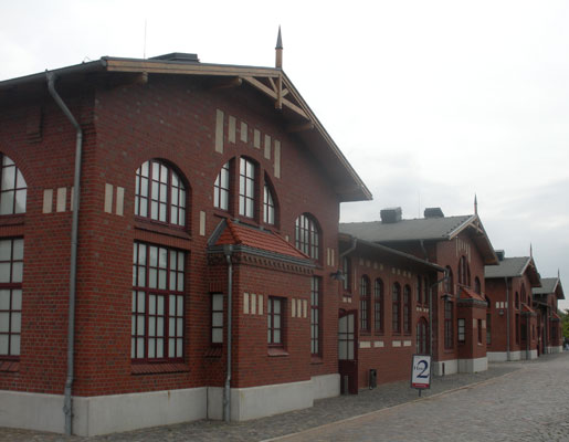
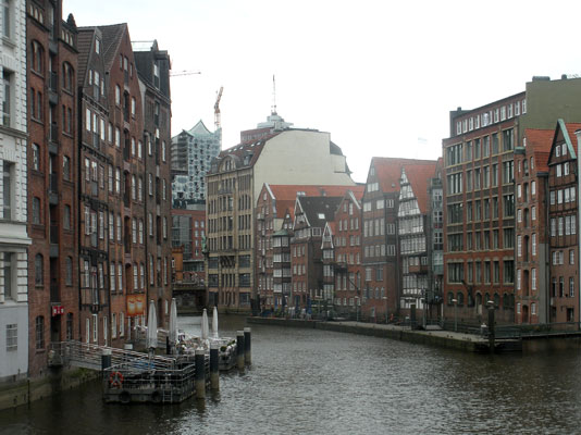
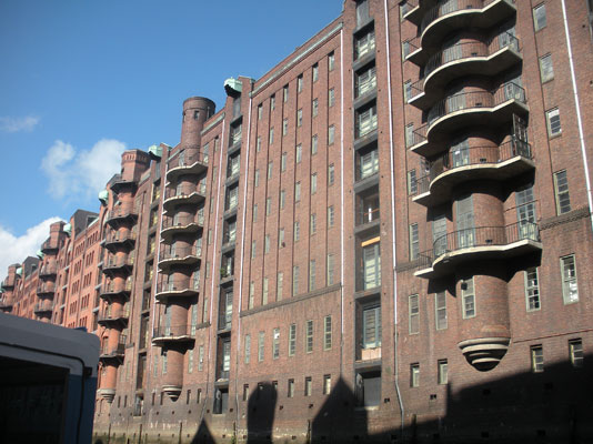
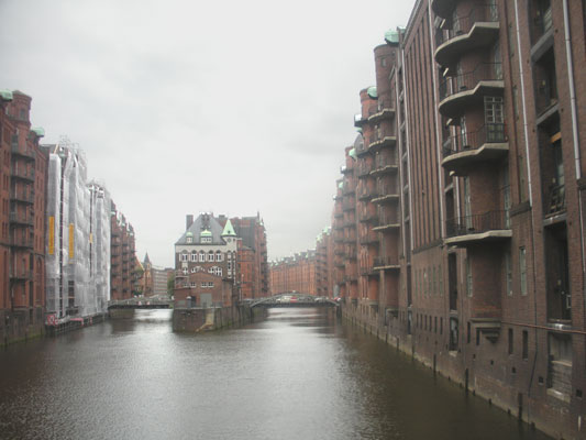
Then, in the 1880s, the Speicherstadt (Warehouse City) was built. These long and massive brick buildings became the world's largest single warehouse complex, even today. These warehouses provided space for the long-term storage and customs-free handling of foreign goods for over a century, until January, 2003 when the privilege was rescinded as no longer needed.
By 1913, Hamburg had a million residents. The Port was the most important on continental Europe and the third-largest in the world after London and New York.
Then came the Second World War when over 80% of the Port's facilities were destroyed. After the war, rebuilding of the Port, Hamburg's economic lifeline, was swift.. By 1953 the city had already invested the equivalent of 115 million Euros in the Port and by 1955 the annual handling volume had reached prewar levels.
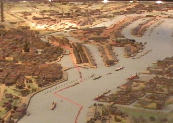
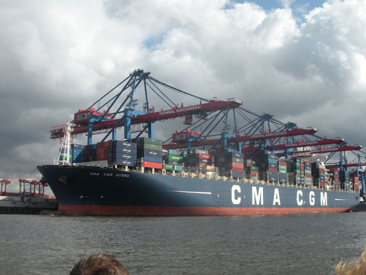
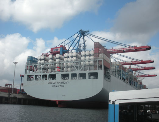
In the 1960s, the "industrialization of shipping": occurred as container shipping was introduced and rapidly expanded. Hamburg's historic hafens could not be adapted to these new demands with the result that new and larger facilities were built on the south side of the Elbe. The opening of the Köhlbrand Bridge and the new Elbe Highway Tunnel linked the city with the new port facilities, facilitating the "Leap across the River". .
Today, the Port of Hamburg is the third largest in Europe, behind Rotterdam and Antwerp and is not only the largest German seaport, but also the ninth-largest container port worldwide. For residents, the port continues to be a primary component of the city's economic vitality, a vibrant trade and industrial base that creates thousands of jobs and plenty of profits.
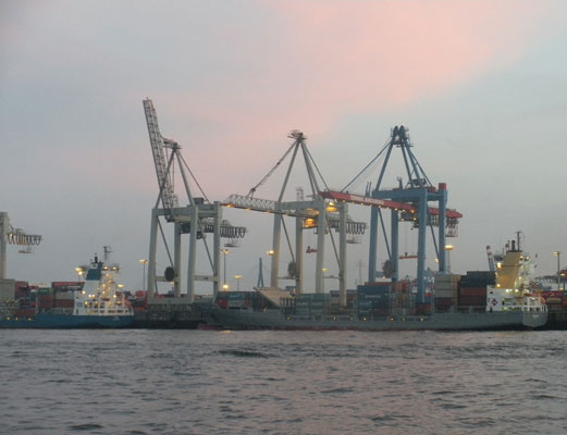
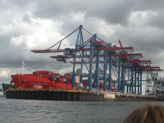
But the cranes and massive ship buliding and maintenence structures across the Elbe and the lumbering giant container ships and tankers plying the waters today bear little resemblance to the old port of Hamburg with its quays lining every insel along the riverfront providing safe landings for dozens of sailing ships and overlooked by tall brick warehouse buildings with overhead cranes for loading and unloading goods.
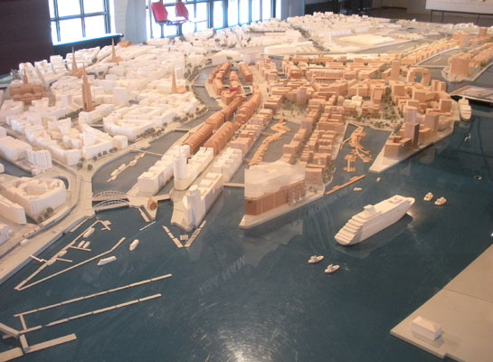
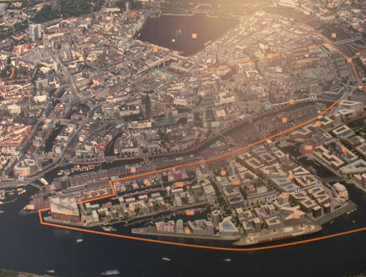
Now neglected with the move of the port across the river, these lands that the old port had occupied for over 800 years, offered the City of Hamburg an enormous development opportunity and challenge. The result is HafenCity which we describe in another story titled HafenCity - Hamburg's Bold New Venture in Urban Living
Below is our picture of the model of the planned development and an aerial view map of its place in the city.
Click here to return to our 'Summer 2011 - Joys of Urban Living' page
![]()