Quito - A City Shaped by Its Geology
![]()
Unlike most visitors to Ecuador, we had left a visit to Quito until the end of our journey. As the bus climbed up from the Amazon basin, around the curves of the highway, laboring to carry us and the rest of the passengers up from 500 meters to 2850 meters above sea level, we wondered what we would find. The scenery along the way was certainly spectacular with deep valleys cutting into the mountains, covered with greenery alternating with sheer rock faces.
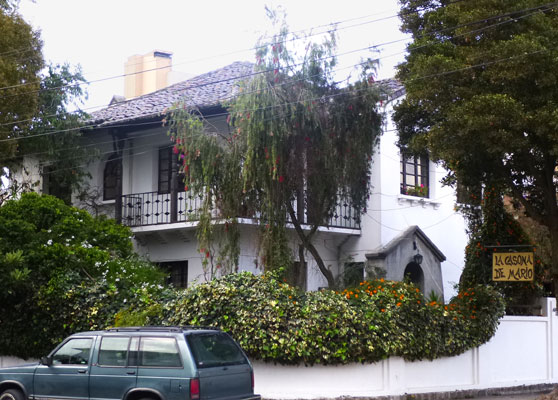
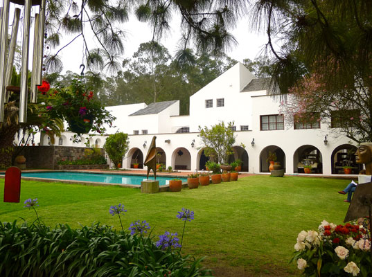
After traveling for about four hours, we began to see the outermost edges of the city: houses of concrete block clinging to the sides of impossibly steep hillsides. For the next hour, the buildings and the traffic thickened as the bus twisted its way through the city to its destination, Terminal Terrestre Quitumbe, Quito's shiny new bus terminal on the far south side. From there, the taxi took us to Casona del Mario in La Floresta, our home for the next two weeks. After ringing the bell, we were greeted by a young woman who took us to our room and directed us to a desk where we signed the big ledger to check in.
We should point out that the taxi ride, which took over a half hour, cost us only $8.00, an amazingly low price for a ride in any capital city! It was interesting to find a system that is well enough used so that taxis are always available, and at reasonable cost, making them a attractive alternative to owning a car. Over the following days, we used it frequently.
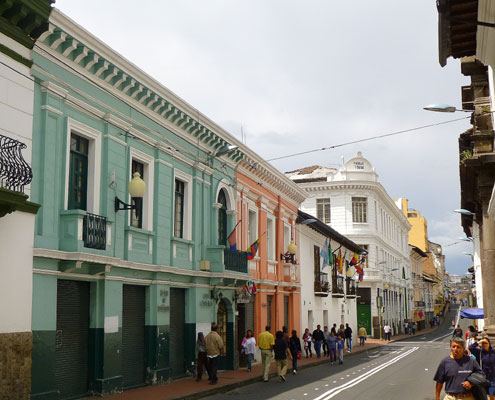
We headed out to explore our new barrio. La Floresta is a classy suburb on the east side of La Mariscal, the New Town where most international visitors gather. A friendly cafe offered us a long overdue lunch and a further stroll introduced us to the myriad of cafes and restaurants in the area.
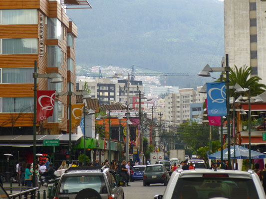
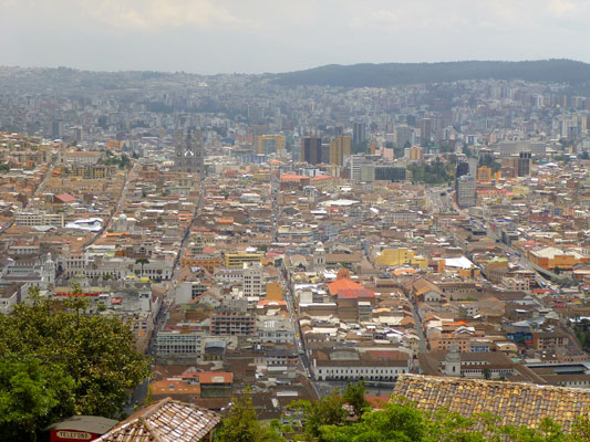
Initially, we found it difficult to understand Quito's layout. Situated on a long plateau in the foothills of the Pichincha Volcanic range to the west, the city is about 40 kilometers long but only 5 or so kilometers wide. To the east, the plateau slopes off abruptly into a wide valley, Valle de los Chilos, creating definite challenges for urban expansion.
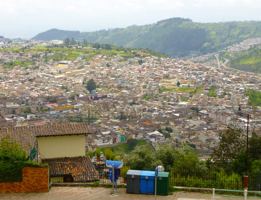
To gain a better understanding of the local geography, we hopped onto a Hop On-Hop Off bus. The HO-HO bus covered many places of interest and gave us a much better concept of the city's layout. After a few stops, the bus ascended to the top of El Panecillo, a hill arising just south of the Centro Historico. From here, the city spread to the south and north as well as up into the foothills and volcanic peaks to the west, and over the edge of the valley to the east.
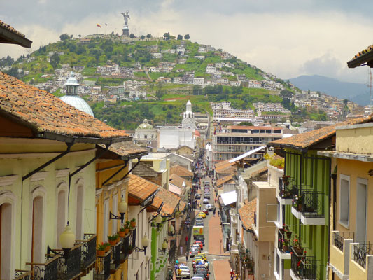

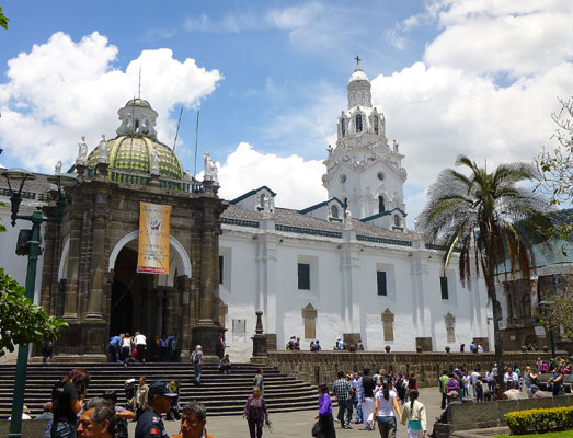
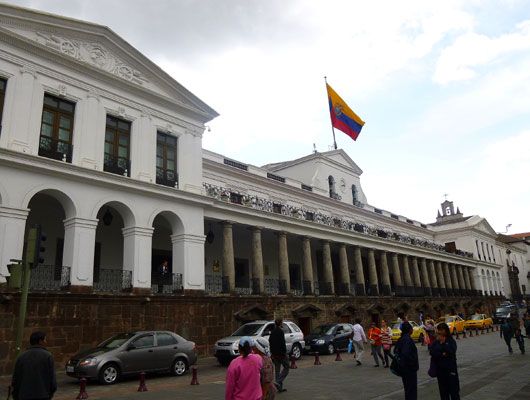
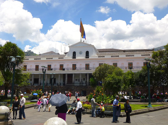
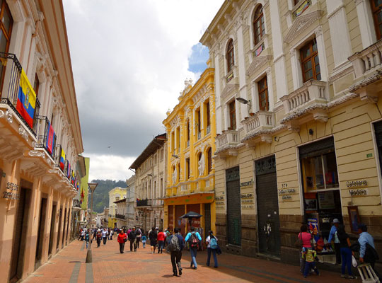
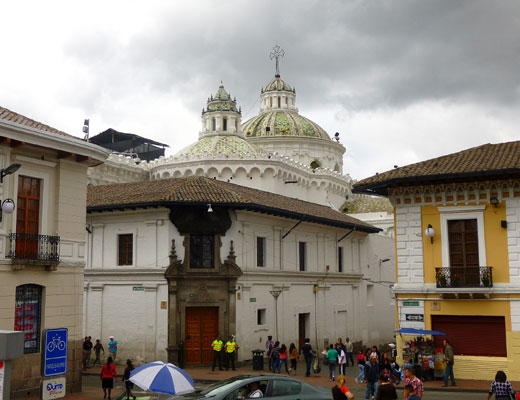
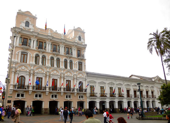
The following day, a Sunday, we headed to the Centro Historico, where multitudes of folks gathered to enjoy the day. On Sundays, cars are excluded so people fill the calles, eating conos de helado (ice cream cones), strolling and hanging out so we joined them happily. The Plaza Grande (or Plaza de la Independencia) in the very center of the Centro Historico, with the Catedral Metropolitana on one side, the Palacio de Gobierno on another, the Palacio Arzobispal on another and the Palacio Municipio on the fourth, is Quito's heart. The monument in the center celebrates Ecuador's revolution and independence from the Spanish.

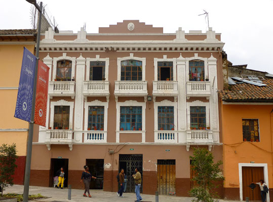
The Centro Historico was designated a World Heritage Site by UNESCO in 1978. This designation encouraged the city to take steps to preserve their heritage. As described by UNESCO, "The city is in great part laid out in rectangular squares, the streets approximately aligned on the cardinal points of the compass. The houses of Quito are chiefly built in the old Spanish or Moorish style. The building material in general use is sun-dried brick, covered in the better houses with plaster or stucco."
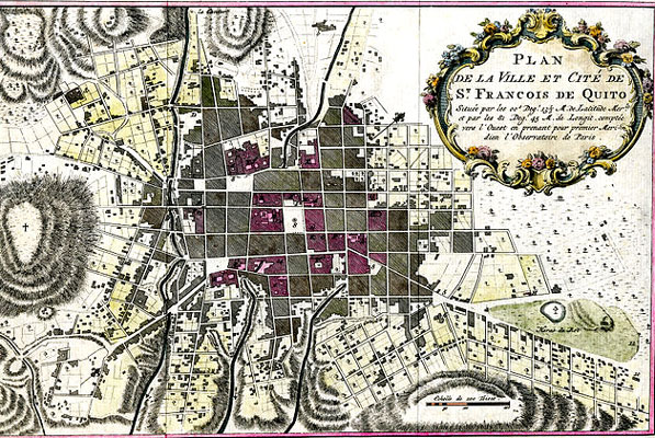
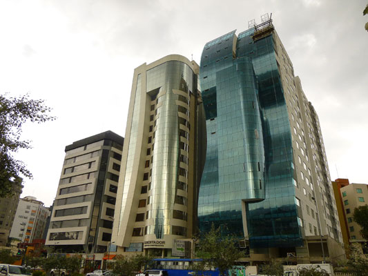
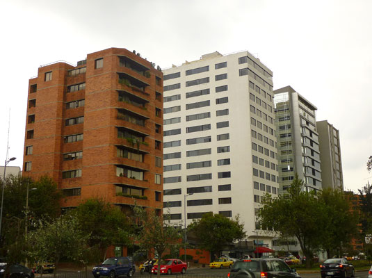
We were amazed to learn that at the beginning of the 20th century, all of Quito fit within the boundaries of the Centro in an area of 3.75 square kilometers (790 acres) when the population was only 50,000. By 1990, the Metropolitan Area of Quito was home to 1 million people and by 2010, the population was over 2 million, having expanded both north and south of the historic downtown and into surrounding valleys. Upward expansion of high rise buildings was an additional aspect of this remarkable growth.
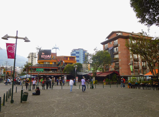
During our days in Quito, we visited museos, iglesias, parques, the Capilla del Hombre and casa of artist Oswaldo Guayasamin, attended a concert at the Casa de Cultura, and rode the Tren Ecuador south to Boliche. In between, we shopped in the Mercado Artesanal, explored several residential barrios, rode the buses, shopped in the big SuperMaxi food market and the Friday farmers market just up the street, and ate lots of yummy food. So most of the time, we were tourists, but some of the time, we experienced urban life in La Floresta.
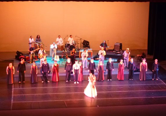
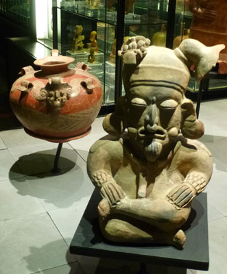
Quito's museos offer an amazing range of information and insight about the city's Spanish colonial and republican history, the influences of the many indigenous cultures and their skill and artistry. The Casa de Cultura offered an astounding array of cultural experiences - music, dance, cinema, and important collections of art from every district of the country.
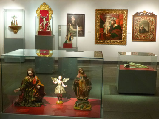

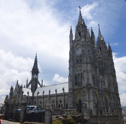
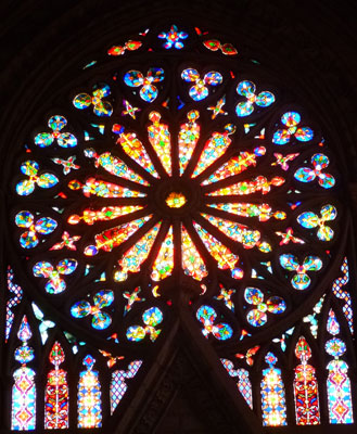
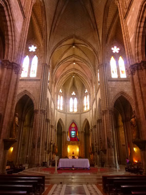
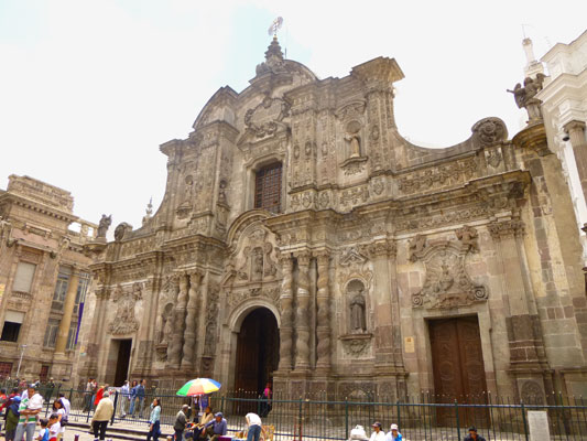
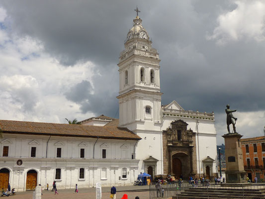
Through visits to the many iglesias we experienced the influences of the religious orders - Jesuit, Dominican, Franciscan and others - and the artistic skill and accomplishmnts developed in Quito through the Quito School.
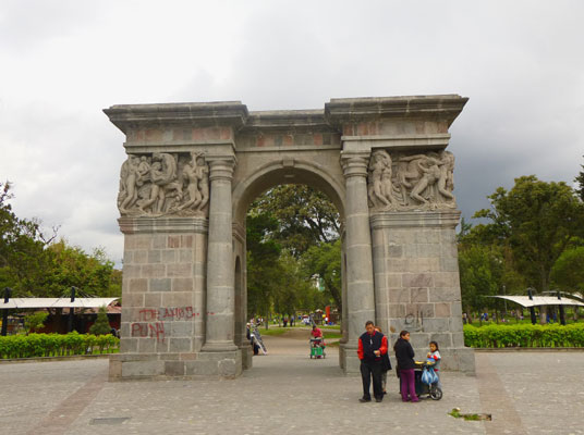
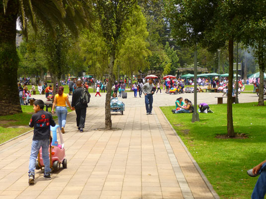
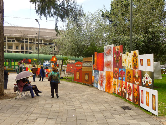
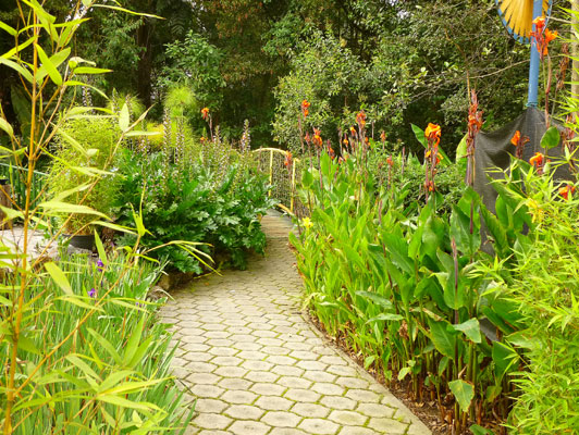
The city's parques offered us, as well as the Quitanos, opportunities to get outside, relax and play, view artwork by local artists and stroll through a botanic garden.
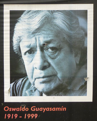
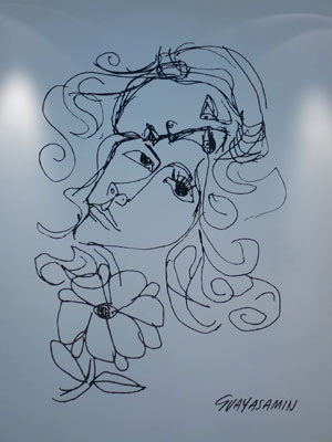
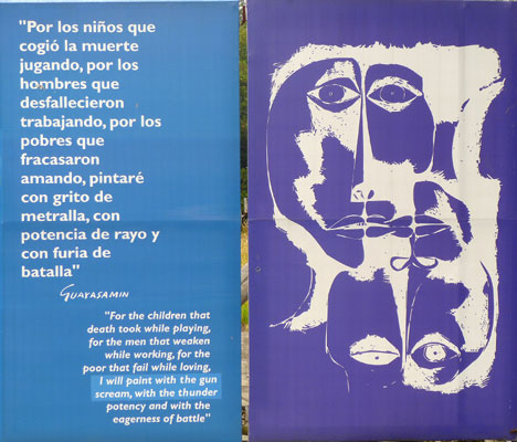
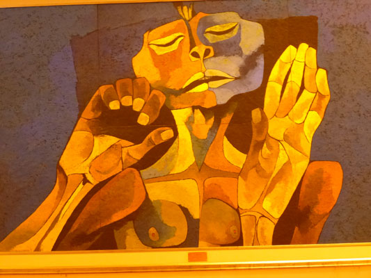
Our visit to the casa of Oswaldo Guayasamin and his emotional Capilla del Hombre offered a glimpse into the mind and artistry of this Ecuadorian artist. His large scale murals of people enduring suffering and agony inside the Capilla stirred our souls. The tour through his casa, furnished with art he had collected, furniture he selected, and personal photos with important people such as Fidel Castro, Hugo Chavez and others gave us insights, too.
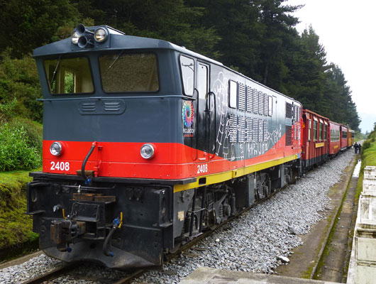
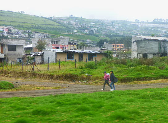
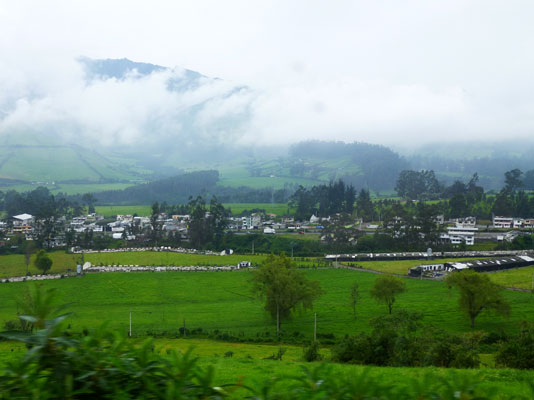
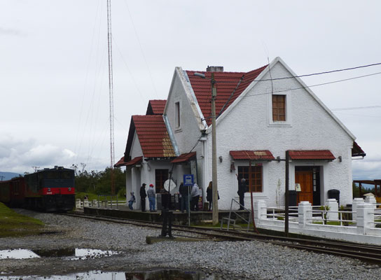
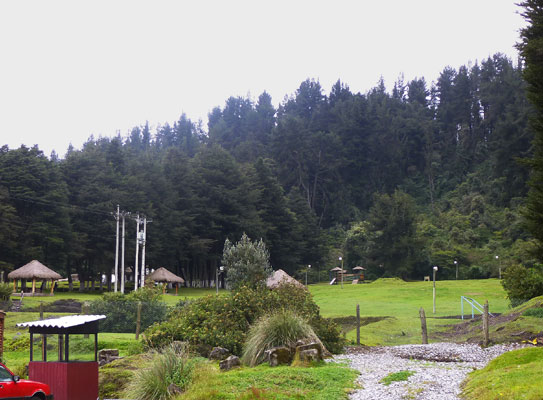
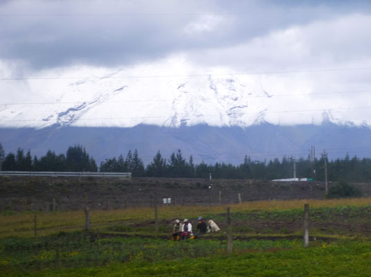
One day, we traveled on Tren Ecuador from the historic estacion south through the sprawling south Quito suburbs of informal homes interspersed with industrial facilities, into the broad valle between the cordilleras of volcanic peaks, to Boliche. This ride took us through rich farmland, villages, and into a forest preserve. On the return journey, the clouds lifted enough to reveal the gleaming snowy slopes of Cotopaxi!
Although, the available time was not sufficient for us to fully analyze Quito's People Friendliness, we have a few observations to share about the Mobility Options.
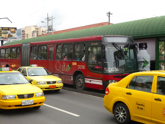
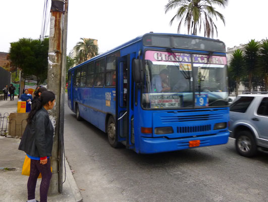
Public transit includes three parallel lines of Bus Rapid Transit, the Ecovia, Trollebus, and Central Norte. The vehicles are high capacity 'bendy buses' that stop at stations with raised platforms so passengers can just step on and off. However, we soon discovered that actually riding these buses was a big challenge, due to the heavy ridership, so we used them less frequently! Big blue buses also ply the streets serving dozens of routes, their major destinations posted on the front windows. Once, we figured out a few of the routes, these were more useful to us! Still, many Quitanos just drive their cars rather than deal with these barriers, which creates serious traffic problems at certain times of day.
The Quito city fathers realize that better mobility options are essential and construction of an underground metro is underway. This will be a great step forward for this city!
Click here for more info
Overall, Quito offered us an exciting, informative, fun, and thought provoking finale to our Ecuador journey.
Click here to return to our 'Ecuador - First Nomad Journey of 2013' page.
Click here to return to our 'Searching the World for People Friendly places' page
![]()